Following the Prime
Minister’s decision on March 23rd, to introduce tighter movement
restrictions across the UK, and following the irresponsible behaviour of some
people last weekend, the National Park Authority, working in cooperation with
the local authorities and other partners, has closed those areas of the
National Park which are popular with visitors and which pose a risk for the
transmission of coronavirus.
These closures ensure that the Authority is complying with the “Health Protection (Coronavirus: Closure of Leisure Businesses, Footpaths and Access Land) (Wales) Regulations 2020” introduced by Welsh Government this week. The areas affected are listed at the bottom of the page.
Bannau Brycheiniog National Park Authority Chief Executive, Julian Atkins, said: “The movement restrictions now in force are necessary to prevent the spread of coronavirus and it is essential that the public listens and acts immediately to the instructions which have been issued. While we all enjoy getting out into the countryside, locations which attract people to gather or come into contact with each other now pose a risk to our health and it is important that we take the steps necessary to protect lives. We have not taken this decision lightly but these closures are important if we are to play our part in slowing the spread of the virus and they must be respected. The National Park will still be here when restrictions are lifted but for now we must put these closures in place. Many elderly people live in our National Park and access to hospitals and NHS services can be more difficult for some, please help everyone stay safe.”
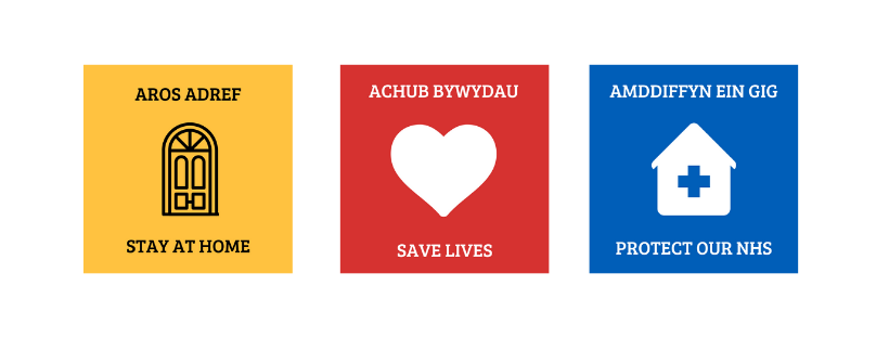
Please follow Government restrictions and stay at home to save lives and protect our NHS. You are allowed to leave your home only in the following exceptional circumstances:
- To shop for “basic necessities”, as infrequently as possible.
- For medical reasons, to provide care, or to help a vulnerable person
- Travelling to and from work, but only if it is “absolutely necessary”
You can go out to exercise once a day, but this should be close to your home.
The Sites/ Paths/ and Areas of Access Land which are now CLOSED across the Bannau Brycheiniog are:
UPDATED 27.03.2020
List of Bannau Brycheiniog National Park Closures
Access land/public paths closed by virtue of The Health Protection (Coronavirus Restrictions) (Wales) Regulations 2020
BB-1 Central Beacons
All areas of access land, above the hill fence, comprising of the Central Bannau Brycheiniog including Pen y Fan, Corn Du, Cribyn, Fan y Bîg, Waun Rydd, Allt Lwyd, Torpantau, Pant y Creigiau, Bryniau Gleision, Cefn yr Ystrad, Cefn Cil-Sanws, Garn Ddu, Cefn Car, Waun Wen, Waun Lysiog, Twyn Mwyalchod, Graig Fan Ddu, Gwaun Taf, Gwaun Perfedd, Cefn Crew, Tyle Brith, Pen Milan, Y Gyrn, Cefn Cwm Llwch, Bryn Teg, Cefn Cyff and including all public footpaths, bridleways and restricted byways within those area. In addition, the Storey Arms car park
BB-2 Waterfalls Country (Pontneddfechan, Ystradfelte and Penderyn)
All areas of access land in the Waterfall Country and all public footpaths and bridleways located on access land. In addition public footpath no. 17 commencing at Penderyn (SN94481,08918) and leading to Sgwd yr Eira, bridleway no. 32 commencing at Dinas Rock (SN91569,08079), public footpath no. 42 commencing from a point north of Clyn-Gwyn car park (SN91819,10763), public footpath no. 84 commencing from Clyn-Gwyn car park (SN91878,10566), public footpath no. 42 commencing from Cwm Porth car park (SN92825,12370) and public footpath no. 18 commencing from the A4059 near Pant-Garw (SN94432,09959)
BB-3 Black Mountains – East
All areas of access land including roadside parking areas, above the hill fence, within the Black Mountains comprising of Hay Bluff and Ffynnon y Parc and extending south along the Hatterrall Ridge to and including Hatterrall Hill including all public footpaths and bridleways within those areas
BB-4 Black Mountains –Central
All areas of access land, above the hill fence, within the Black Mountains including Waun Fach, Pen y Manllwyn, Y Grib, Rhos Dirion, Twmpa, Waun Croes Hywel, Darren Lwyd, Gadair Fawr, Mynydd Llysiau, Pen Twyn Glas, Pen Allt-mawr, Pen Cerrig-calch, Pen Twyn Mawr, Pen Garreg, Crug Mawr, Blaen yr Henbant, Partrishow Hill, Twyn Talycefn, Y Fan, Bwlch Bach, Bâl Mawr, Bâl Bach, Garn Wen and y Gaer and including all public footpaths, bridleways, restricted byways within those areas
BB-5 Black Mountains – West
All areas of access land including roadside parking areas, above the hill fence, adjacent to the Black Mountains comprising of Rhos Fach and Rhos Fawr including all public footpaths and bridleways within those areas
BB-6 Offa’s Dyke National Trail
Offa’s Dyke National Trail, above the hill fence where it meets access land, between grid reference SO23868,39549 south of Cadwgan (Hay-on-Wye) and SO32447,22753 west of Trewyn Farm (Pandy)
BB-7 Mynydd Du
All areas of access land including roadside parking areas, above the hill fence, within the Black Mountain and the Western Great Forest including Mynydd Bach Trecastell, Mynydd Myddfai, Fedw Fawr, Waun Lwyd, Garn Lâs, Twyn yr Esgair, Moel Feity, Bannau Sir Gâr, Fan Brycheiniog, Waun Haffes, Cefn Twrch, Garreg Las, Waun Fignen Felen, Carreg Goch, Dorwen ar Giedd, Llorfa, Cefn Carn Fadog, Foel Fraith, Garreg Lwyd, Feol De gar Bedol, Tair Carn, Mynydd Isaf, Drysgol including car parks at Llyn y Fan Fach, Herbert’s Quarry and Brest Cwm Llwyd and all public footpaths and bridleways within those areas
BB-8 Eastern Great Forest and Manor Mawr
All areas of access land including roadside parking areas, above the hill fence, within and adjacent to the Eastern Great Forest and Manor Mawr including Fan Fawr, Rhos Dringarth, Fan Dringarth, Fan Frynich, Twyn Dylluan-ddu, Craig Cerrig Gleisiad, Fan Llia, Waun Llywarch, Ton Teg, Waun Tincer, Mynydd y Garn, Gwaun Cefn y Garreg, Cadair Fawr, Pant y Gadair, Cefn Cadlan, Garn Ddu, Cefn Sychbant and Mynydd-y-glog and all public footpaths and bridleways within those areas
BB-9 Mynydd Illtud
All areas of access land including roadside parking areas, above the hill fence, within Mynydd Illtud including Twyn y Gaer, Allt Lom, Daudraeth Illtud and all public footpaths, bridleways and restricted byways within those areas
BB-10 Mynydd Troed, Mynydd Llangors, Pen Tir and Cefn Moel
All areas of access land including roadside parking areas, above the hill fence, comprising of Mynydd Troed, Mynydd Llangors, Pen Tir and Cefn Moel and all public footpaths, bridleways and restricted byways within those areas
BB-11 Skirrid Fawr
Skirrid Fawr (SO32983,17857) and all public footpaths within that area along with public footpath no. 182 which commences from the Old Ross Road at SO32824,16375 to its connection with access land at SO32730,16953
BB-12 Allt yr Esgair
Bridleways nos. 8 and 10 commencing from SO12941,22706 at the A40 layby at Talybryn, Llansantffraed and heading towards Allt yr Esgair
BB-13 Table Mountain, Crickhowell
The area of access land comprising of Table Mountain, Crickhowell and all public footpaths within that area along with public footpath no. 9 between SO22408,19864 and SO22491,20321 and bridleway no. 5 (Cwm Cwmbeth) between SO21956,20081 and SO21826,20885
BB-14 Garn Goch, Bethlehem
Garn Goch, Bethlehem (SN69130,24342) including the public footpath within that area and the car park
BB-15 Carreg Cennen
Carreg Cennen woodland, carpark and circular walk including public footpaths nos. 34, 35, 36, 37 and 38 between SN66512,19093; SN67133,19067 (Hengrofft); SN67663,18906 and SN68862,19062 (Wern-Wgan)
BB-16 The BeaconsWay
The Beacons Way where it crosses any of the above areas along with the section that follows public footpaths nos. 33, 34 and 35 between SN85598,15466 and SN90814,14348 between Penwyllt and Blaen Nedd
Other sites that are closed
BB-17 Craig y Nos County Park
BB-18 Keeper’s Pond (SO25480,20735) and Foxhunter (SO26324,210750) car parks
BB-19 Llangasty Birdhide (SO12651,26224) and car park by Llangasty Church (SO13287,26186)
BB-20 Blaen Onneu car park (SO15712,17087) off the B4560 and Llangattock escarpment car park (SO20919,215391)
BB-21 Picnic site adjacent to Craig Cerrig Gleisiad adjacent to the A470 (SO97129,22174)
BB-22 The National Park Visitor Centre and car park
BB-23 Upper and Lower Blaen-y-glyn car parks at the head of the Talybont valley at SO05645,27599 and SO06321,170444
BB-24 The areas of land including roadside parking areas, above the hill fence comprising of the Sugarloaf and the Deri and all public footpaths and bridleways within those areas along with the car parks in the vicinity of the Sugarloaf at y Fro (SO29228,20032) and Llwyn-du (SO28372,16184)
BB-25 Informal car park near Carreg Cennen castle (SN67072,19020)
BB-26 Mynydd Ddu Forest car parks at Blaen Y Cwm (SO25297,28387) and Cadwgan (SO26720,25134)
BB-27 Taf Fechan Forest car parks at Owl’s Grove (SO04872,16259), Pont Cwmyfedwen (SO04235,16399) and Neuadd (SO03768,16960)
BB-28 Garwnant Visitor centre (SO0304,13117) including car park, toilets, play areas and bike trails
BB-29 Car parks in Waterfall Country namely Clun Gwyn (SN91868,10580), Cwm Porth (SN92844,12427), Gwaun Hepste (SN93561,12355), Pont Melin Fach (SN90792,10486) and Dinas Rock (SN91095,07931)
BB-30 Car park at Ogof Ffynnon Ddu National Nature Reserve (SN85617,15555)
BB-31 Car park at Glasfynydd Forest, Pont ar Wysg (SN82003,27134)
BB-32 Car park at Cwm Giedd forest (SN79141,12772)
BB-33 Car park at Pen Arthur forest, Llangadog (SN71715,25590)